There are numerous beginner-friendly hiking trails in Canmore, Alberta, Canada. The easy trails listed below are accessible for most people, are generally pet friendly, and offer unbelievable views of mountains, lakes, rivers, and more. All without leaving the comfort of a quaint little mountain town.
The town of Canmore is nestled in Alberta’s Rocky Mountains. An area known as a hiking mecca for its stunning natural landscapes and mountain peaks.
Whether you are visiting Canmore for a weekend getaway or a work event, are passing through or you live here, there are near countless opportunities to experience the great outdoors. Many of them don’t even require you to leave town.
On several occasions visiting Canmore we leave our car parked and explore by foot. Getting lost on purpose by meandering the trails and following our feet is the best way to experience this mountain town. Nothing is too far and you will always find your way back. And if for some reason you don’t, there are enough active friendly people milling about for you to ask directions from.
Reset in Nature and Reap the Benefits
Spending time in nature is one of the best things you can to improve your health in a holistic way. It improves mood, reduces stress, and enhances self-confidence. In addition to the mental health benefits, it’s a great way to improve physical health. Hiking improves cardiovascular health and may help one achieve fitness goals. It’s also an opportunity to meet new people and feel more connected to the earth.
These are just a few of the many benefits of hiking in nature. And what’s great is you don’t need to spend hours hiking up mountains or nights camping underneath the stars. Those are all amazing and great experiences to have, but there are easier ways to reap the benefits of time spent in nature.
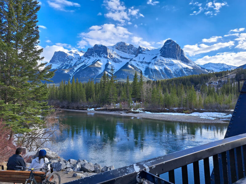
Hikes in the Town of Canmore
You don’t need to leave the town of Canmore to experience the best the Rocky Mountains have to offer. There are several beginner-friendly hiking trails in Canmore that start right in the center of town. Some meander through the town itself. All of them take you through stunning forested areas, alongside rivers, and provide unparalleled views.
Policeman’s Creek Trail
Distance: Varies 1.3km to 4km | Elevation: 72 meters
As far as beginner-friendly hiking trails in Canmore go, this may be the best. Located right in the heart of Canmore, Policeman’s Creek offers multiple trails and boardwalks for you to explore. We walk part of this trail at least once every time we visit Canmore.
Policeman’s Creek Trail has several entry points, making it easy to access and adapt to your needs. The trail connects to several other trails in town so you can easily extend your adventure.
The most popular starting point of the trail is near the intersection of Main Street (8th Street) and Spring Creek Drive. It’s near impossible to miss. There is a giant head sculpture (the Canmore Big Head) on one side and a picturesque wooden boardwalk on the other.
It’s a flat, easy, gentle trail suitable for most people. The trail is anywhere from 1km to just under 4km, depending on which direction and loop you take.
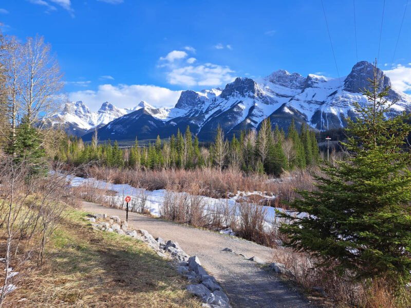
The sights along the trail are beautiful. There is ample opportunity to enjoy scenic views of the Three Sisters mountains, Ha Ling Peak, and Mount Rundle. If you are lucky, you will see wildlife including elk, birds, beaver, and squirrels.
Policeman’s Creek Trail is a delightful easy hike to include in your trip to Canmore.
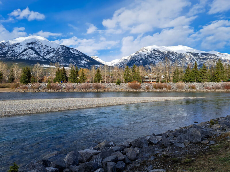
Bow River Loop Trail
Distance: 2km | Elevation: 164 meters
Another scenic trail that starts right in Canmore offering beautiful views and flat terrain is the Bow River Loop Trail.
Along with Policeman’s Creek Trail, the Bow River Loop Trail is one of the most popular trails in Canmore. At any time of day throughout the year you will find walkers, joggers, and cyclists enjoying the trail.
To access the trail, head south on Main Street until you reach 8th Avenue. Turn left onto 8th Avenue and follow it as it heads towards the Bow River. There are multiple entry points to the trail on either side of the Bow River.
Along the trail you’ll cross many steel bridges, including Canmore Engine Bridge. This is the bridge they crossed in the “The Last of Us” TV show. From this bridge there are beautiful views of nearby mountains that are not to be missed.
Bow River Trail
Distance: 6km | Elevation: 129 meters
The Bow River Trail is an out and back choose your own adventure path along the Bow River. It can be as short or as long as you like. Following it the full 6km will lead you to a viewpoint of the Three Sisters mountains.
This area is popular for birding, fishing, and hiking. To get here, stay along the Canmore side of the Bow River and follow it south past Millennium Park.
Trans Canada Trail: Canmore, Three Sisters Pathway
Distance: 6.1km | Elevation: 153 meters
The Canmore portion of the Trans Canada Trail starts on the opposite side of the Bow River. From Canmore, cross the Bow River Bridge and head south along the trail.
Officially 6.1km one way, it is a 12.2km out and back trail. However, you can choose your own adventure and follow the trail for as long as you like before heading back. However long you go, you will be treated to epic viewpoints along the way.
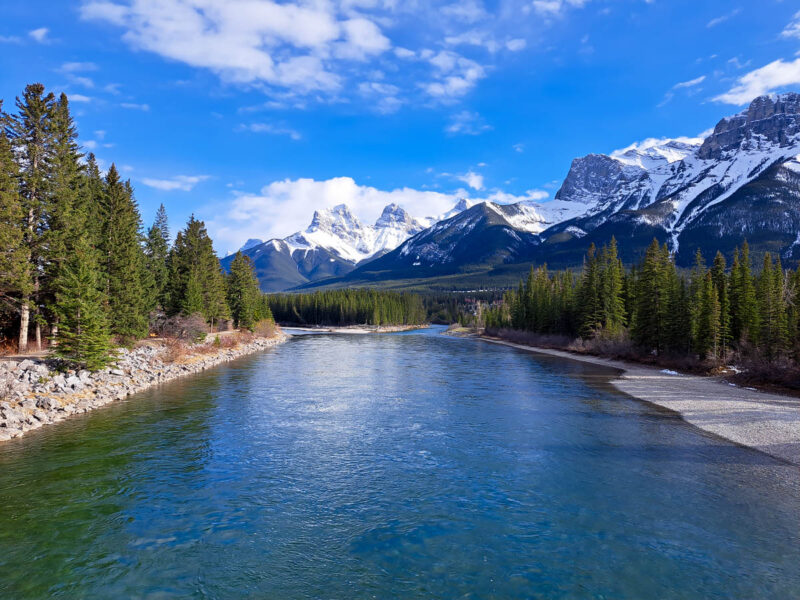
Canmore Creek Trail
Distance: 3.2km | Elevation: 88 meters
Instead of continuing down the Trans Canada Trail, you may opt to follow the Canmore Creek instead. This walk begins along the Bow River before cutting through the neighborhood to follow alongside Canmore Creek. It’s an easy and peaceful walk suitable for everyone and any day.
Larch Island Loop
Distance: 5.6km | Elevation: 123 meters
The Larch Island Loop is a longer trail option in Canmore. There are several access points and it joins up with a few other previously mentioned trails, including Policeman’s Creek Trail.
I’ve seen a few different routes for the Larch Island Loop floating around online, so there isn’t necessarily a right or wrong path to take. Head towards the quieter and slightly more remote area of Larch District and Larch Island. You can access the trail walking along the Bow River, Policeman’s Creek, or meandering streets in town.
A common route is walk north from the Big Head, following Policeman’s Creek heading upstream for about 1km. Cross 17 Street and continue walking past the Canmore High School and the Canmore Golf & Curling Club on your right-hand side.
There are trail maps along the way. And fear not, with so many trails either leading to the Bow River or into town, it’s hard to get too lost. You will almost always see other people on the trails who will happily point you in the right direction.
Larch Island Interpretive Trail
Distance: 1.9km
This easy 1.9km loop is located off the Larch Island Loop Trail. It’s a peaceful picturesque stroll through a protected, sensitive area.
Currently, May 2024, it appears to be closed according to Google, with the last reviews in late 2023. If and when it opens up again, it’s a beautiful and informative trail with informative signs scattered throughout. You’ll learn about the area’s natural and cultural history while enjoying the sights and sounds of plants and wildlife.
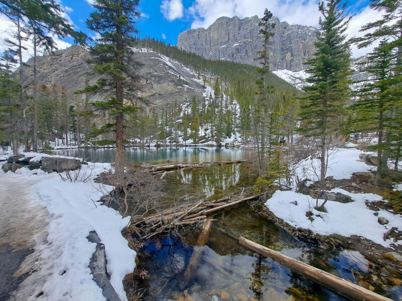
Just Outside Canmore
The beginner-friendly hiking trails in Canmore mentioned above can likely be walked to from your accommodation. The following hikes are a bit further and may require you to either drive to access them or use public transport. However, if you’re an avid walker wanting to extend your hike and don’t mind a bit of road, you could also walk to them.
As you leave Canmore, you will need a Kananaskis Conversation Pass if driving and stopping to hike or camp anywhere in Kananaskis Country and the Bow Valley Corridor. You can purchase the pass online either as a day pass for one vehicle, or a yearly pass for two license plates. The passes can also be purchased at the Kananaskis Visitor Centre.
Quarry Lake
Distance: 1.3km | Elevation: 43 meters
Quarry Lake Park is about 3.5km from the center of Canmore. The park and surrounding trails have so much to offer. There are incredible views of Ha Ling and the East End of Rundle. Endless nature and wildlife viewing opportunities. Benches and picnic tables to relax at. Not to mention, an actual lake to go swimming in.
It’s a busy area but worth it to explore, especially if you can go a bit further than the basic loop and traverse the slightly more challenging routes.
To get here from Canmore, take the Three Sisters Parkway Highway 742, and follow the signage towards the Canmore Nordic Centre. Quarry Lake will be on the left-hand side before you reach the Nordic Centre.
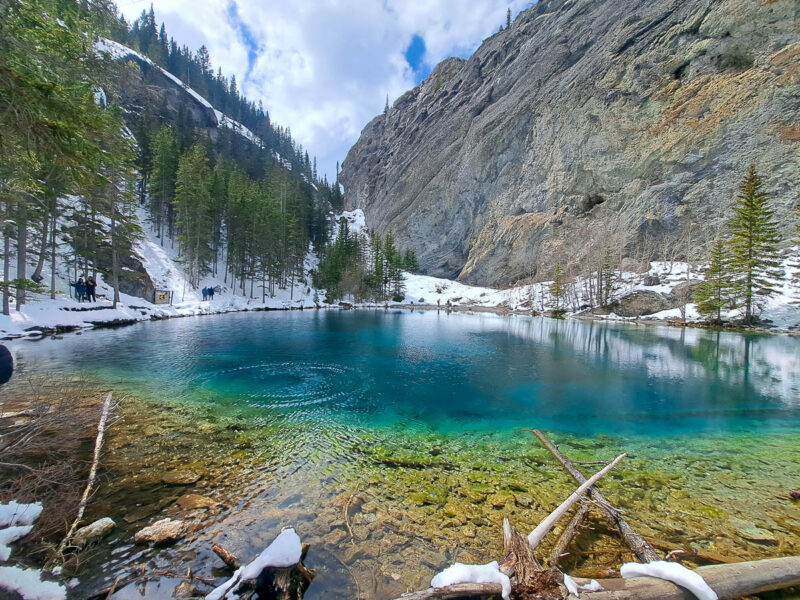
Grassi Lakes Trails
Distance: 4km | Elevation: 125 meters
Visiting Grassi Lakes is one of, if not the, most popular hiking trails in and around Canmore. There are two stunning turquoise lakes, incredible views of Canmore and Bow Valley, and even a waterfall depending on the route you take.
The easier route, the Upper Grassi Trail, takes you up a gentle incline on a wide path. The more difficult route (to the left) takes you through a more wooded area past the Lawrence Grassi Waterfall.
Both trails take you to the gorgeous, green colored pair of Grassi Lakes. Since both trails arrive at the lake, you can take one on the way up and one on the way down.
At the time we visited in 2024, the more difficult Grassi Lakes Trail was closed for trail construction and erosion mitigation work. Despite this, the Upper Grassi Trail was just as spectacular and not too overcrowded.
What are some other beginner-friendly hiking trails in Canmore that you like? Let me know in the comments section!






One Response
Really noo matter if someone doesn’t know afterward its upp to other
people that they will assist, so here it occurs. https://waste-ndc.pro/community/profile/tressa79906983/